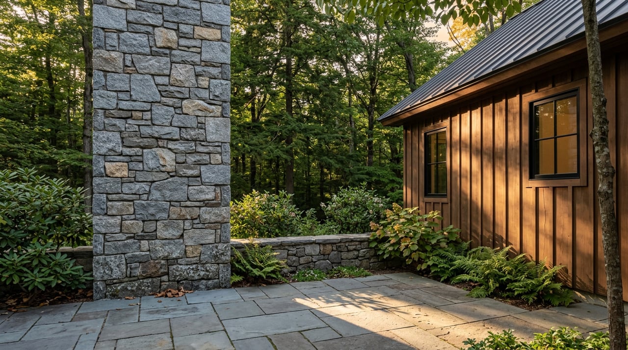
If you have ever fallen for a mountain parcel in Otto Springs, you know how easy it is to picture the view before you picture the work. A beautiful homesite in Otto can be incredibly rewarding, but mountain land asks better questions up front than a flat lot in town. If you want to build with confidence, it helps to understand what to check before you buy, design, clear, or dig. Let’s dive in.
Why Otto land needs early planning
Otto is a rural mountain community in Macon County near the North Carolina-Georgia border along US 441. Macon County’s planning board describes its mission as protecting the county’s mountain heritage and community tranquility, which helps explain why land planning matters here from the start. On mountain property, the view is only one part of the story.
In Otto Springs, the shape of the land, the soils under it, the access to the road, and the availability of utilities can all affect whether a parcel works for your goals. That is why early due diligence matters so much. What looks simple from the road can become more complex once you review septic feasibility, floodplain mapping, watershed rules, and driveway access.
A smart first step is reviewing the parcel in the Macon County GIS map system. The county publishes parcel lines, contours, FEMA flood zones, soils, rivers, structures, and subdivision layers there, which gives you a practical starting point before you spend money on design work.
Start with the land, not the house plan
One of the most common mistakes with mountain land is choosing a house plan before confirming what the lot can support. In Otto, the land should usually lead the process. Slope, soil conditions, stream setbacks, and access needs can all shape what is realistic.
Macon County’s development checklist recommends checking for subdivision issues, Special Flood Hazard Areas, watershed districts, well and septic requirements, erosion control, and stream or wetland impacts. That means your dream layout may need to shift based on the parcel’s constraints.
If you are buying from out of town or planning a second home, this step becomes even more important. A scenic ridge lot may still need enough usable area for the house, driveway, septic field, repair area, and stormwater management.
Check slope, soils, and septic first
For many mountain parcels, septic feasibility is the biggest gate. Macon County says site evaluation considers soil texture and depth, topography, and the size of the suitable area. The county also requires a repair area where a replacement system can be installed if the original system fails.
According to Macon County Environmental Health, buyers may wish to, or may be required to, use a soil scientist or systems designer. The county notes that completed soils reports and systems staked before the site visit can help speed the permitting process.
This is one reason steep land is not automatically unbuildable, but it is not automatically buildable either. The real question is whether the lot has enough suitable space for the home, driveway, septic system, and required repair area.
Macon County also has detailed septic setback rules. For example, a ground-absorption system must be at least 100 feet from private or public water supplies, 50 feet from streams, 10 feet from a property line, and 15 feet from the top of a slope cut or embankment of two feet or more. Those distances can quickly narrow your usable building envelope.
Review floodplain and watershed limits early
In mountain areas, water shapes more than the scenery. Macon County enforces floodplain and watershed protection rules, and those rules can affect where and how you build. In protected drinking-water watersheds, watershed protections can limit impervious surface and lot size.
That is why floodplain and watershed review should happen before you get attached to a site plan. The county’s planning and environmental resources and development checklist make it clear that these reviews belong early in the process, not after design work is underway.
If a parcel includes low-lying ground near water or has a stream crossing the property, this step becomes even more important. A beautiful creekside feature may come with additional planning considerations.
Understand subdivision and road rules
If your parcel is part of a subdivision, there may be added requirements beyond the lot itself. Macon County subdivision rules state that new residential lots not served by public water and sewer must contain enough area for a well, a septic system, and the necessary buffer and drainfield areas.
The county also requires subdivision road maintenance agreements to be recorded for HOA-managed roads. That matters on mountain property, where private roads can be long, steep, and expensive to maintain.
Macon County’s subdivision rules also say roads, culverts, stormwater measures, and driveways must meet county standards. If access roads do not meet standards, that condition must be noted on the plat with an emergency-access caution. For buyers looking at remote or elevated homesites, that is worth understanding before closing.
Verify driveway access before you build
Driveway access can be one of the most overlooked pieces of mountain land planning. If your driveway will connect to a state-maintained road, NCDOT requires a street or driveway access permit. The agency also states that there is no fee to apply and advises property owners to contact the local district engineer for the process.
That sounds simple, but mountain topography can make driveway placement more technical than expected. Grade, sight distance, drainage, and the relationship between the driveway and homesite can all affect design and cost.
A parcel may have road frontage and still need careful planning to create practical access. In Otto Springs, where the terrain can change quickly, this is a detail worth confirming early.
Plan for erosion control and site work
Mountain construction often involves clearing, grading, and managing runoff. Macon County’s soil and erosion ordinance says that if more than one-half acre will be disturbed, an erosion control plan is required. For smaller projects, a land-disturbing permit form is still required, and if the downhill slope is greater than 1:1, a plan is required regardless of project size.
This matters because land prep is often more involved than buyers expect. A short driveway cut, house pad, and utility trenching can trigger requirements depending on the site.
Before any digging begins, Macon County also reminds property owners to call 811. That step is simple, but it is part of building safely and avoiding expensive problems.
Confirm water, septic, and well approvals
For parcels without public water and sewer, your homesite planning needs to account for both septic and well approval. Macon County Public Health says it must approve any construction, addition, alteration, or placement of mobile homes or recreational vehicles before Code Enforcement can issue a permit.
For septic approval, the county wants a tax map or parcel ID, an application, and a site plan or survey plat. For a full Improvement Permit, the survey plat must show property dimensions, the proposed building location, driveway access, the wastewater system site, and well water supplies and surface waters.
The county also says the site should have marked corners, clearly marked items, and ready access for evaluation. In practice, that means preparation helps everything move more smoothly.
For private wells, Macon County requires a permit before a well can be constructed, repaired, or abandoned. The county’s well program also requires existing OSWW permits and a site plan, plus inspection and water-quality steps before final completion.
Do not assume utilities are available
Utility access can vary widely from parcel to parcel in rural mountain areas. Macon County lists Duke Energy, Haywood EMC, and Blue Ridge Electric as utility resources, but buyers should still verify electric service for the exact parcel.
Internet and cell service also deserve careful checking. According to Little T Broadband, rugged terrain and low population density in Otto and nearby Scaly Mountain have made consistent internet and cellular service difficult in some areas. If you work remotely or plan to stream, do not rely on assumptions based on a nearby home.
In mountain real estate, utility verification is not a formality. It is part of deciding whether the land truly fits your lifestyle and budget.
A practical planning sequence for Otto
If you are evaluating land in Otto Springs, this order can help you stay organized:
- Review the parcel in the Macon County GIS system for contours, soils, streams, structures, and flood zones.
- Confirm whether subdivision, floodplain, or watershed rules apply using the county’s planning checklist.
- Order a survey or recorded plat and mark corners, driveway access, the house site, and potential well and septic areas.
- Work through septic and well approvals with Macon County Environmental Health.
- Confirm driveway permit needs with NCDOT if the access point will connect to a state road.
- File any required erosion or land-disturbance paperwork before clearing or grading.
- Pull the building permit, then complete 911 addressing requirements through the county before occupancy.
Why local guidance helps
Mountain land can be exciting, but it is rarely plug-and-play. In Otto Springs, details like contour changes, septic layout, driveway alignment, and utility access can all influence whether a lot feels simple or stressful.
That is where local guidance can make a real difference. When you understand the parcel before you fall in love with the floor plan, you give yourself a better chance at a smoother project, fewer surprises, and a homesite that works with the land instead of against it.
If you are exploring land in Otto or planning your next move in the mountains, Vignette Realty can help you evaluate the story behind the parcel so you can move forward with more clarity and confidence.
FAQs
What should you check first on mountain land in Otto Springs?
- Start with the parcel itself by reviewing contours, soils, streams, flood zones, subdivision layers, and access in the Macon County GIS system before choosing a house plan.
Does steep land in Otto Springs mean you cannot build?
- Not necessarily. The key question is whether the parcel has enough suitable area for the home, driveway, septic system, repair area, and any required erosion controls.
Do you need a survey for a homesite in Macon County?
- A survey plat or recorded plat plus site plan is often central to septic approval, and the county wants property dimensions, house location, driveway access, and wastewater areas clearly shown.
Do driveway permits matter for Otto Springs land?
- Yes. If your driveway will connect to a state-maintained road, NCDOT requires a street or driveway access permit.
Should you verify internet service on land in Otto Springs?
- Yes. Broadband and cellular service can vary by parcel in rugged mountain terrain, so it is best to verify service directly rather than assume it is available.
When does Macon County require erosion control paperwork?
- If more than one-half acre will be disturbed, an erosion control plan is required. Smaller projects still require a land-disturbing permit form, and steep downhill slopes can trigger plan requirements regardless of size.