Hiking the Highlands NC and Franklin NC: Four Trails Our Brokers Actually Use
Ask four people at this brokerage where to go hiking in the Highlands and Franklin area, and you get four different answers. Below are their picks, each paired with what the National Forests in North Carolina actually publish about the trail: distance, difficulty, and how to find the trailhead. Three of the four are in Macon County. The fourth is a longer drive, and we say so.
Pickens Nose: A Short Climb to a Cliff-Edge View
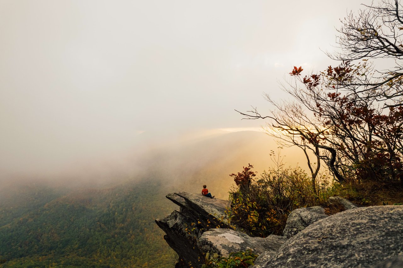
"Pickens Nose because I can bring my children," says broker Ryan Cote. The numbers support that. The Forest Service lists Pickens Nose, trail 13, at 0.7 miles one way, rated moderate, in the Standing Indian Basin area at the edge of the Southern Nantahala Wilderness. The walk climbs through rhododendron to a series of rock outcrops with long views south toward Georgia.
Getting there is the commitment. From Forest Service Road 67, go nine miles past the Backcountry Information Board, then turn right onto Forest Service Road 83, Ball Creek, and watch for the trailhead sign on the right. Both roads are gravel and can rut after heavy rain. Parking is limited, footing at the overlooks is uneven, and the drop-offs are real, so keep children close. Our Pickens Nose trail guide covers the hike in more detail.
The Bartram Trail at Hickory Knoll Road
Broker Jeff Willson's family hikes the Bartram Trail from the Hickory Knoll Road access south of Franklin. "It's close to our house so it's almost like being in our backyard," he says, describing an easy ascent through changing forest with views over the hills toward Otto.
The Forest Service divides the North Carolina Bartram into sections; Jones Gap to Hickory Knoll Road runs 9.6 miles, and Hickory Knoll Road to Wallace Branch continues north toward Franklin. Most people hike part of it out and back. The Blue Ridge Bartram Trail Conservancy describes this stretch as following the spine of the Fishhawk range with views for most of its length, including Whiterock Mountain and Jones Knob, and notes it is especially good in winter when the leaves are down. Follow the yellow blazes, and expect one-lane gravel on the access roads. If you are looking at land in this area, our Otto pages and our post on things to do in Otto cover the neighborhood side of it.
Siler Bald: The 360-Degree Payoff
Broker Rashaune De La Cruz calls Siler Bald "the crown jewel of local hikes," for the uninterrupted panoramas from its grassy summit. The usual route starts at Wayah Gap on Wayah Road, northwest of Franklin, and follows the Appalachian Trail north. Asheville Trails maps that approach is about 1.8 miles to the summit. The Forest Service's Siler Bald Shelter Trail 373 is a 1.09-mile spur off the AT that forms a loop, which is how many hikers make a circuit.
The summit is an open bald, which means weather arrives without warning and the grass is easily damaged. Spread out rather than deepening the worn path, carry a layer even in summer, and turn around early if clouds build. The stone lookout tower at Wayah Bald, built by the Civilian Conservation Corps, sits north along the same ridge system if you want a second stop. Franklin's role as an Appalachian Trail town adds to the appeal; see our Appalachian Trail in Franklin guide.
Art Loeb and the August Blueberries: Worth the Drive
Broker Kristie Brennan's pick is the August climb on the Art Loeb Trail, for the views and the wild blueberries. Be clear on the geography: this one is not local. The Art Loeb runs through Pisgah National Forest, and the popular stretch starts from the Blue Ridge Parkway at milepost 420, on Forest Service Road 816, south of Asheville. Plan a full day from the plateau.
The Forest Service describes section 3 of the Art Loeb as 6.8 miles and difficult, crossing Black Balsam Knob and Tennent Mountain, both above 6,000 feet, and notes that a five-mile loop can be made by combining it with the Ivestor Gap Trail. The Art Loeb Spur Trail nearby is 0.6 miles, steep, and climbs a fragile grassy bald with views the Forest Service says can reach 70 miles on a clear day. Blueberries ripen on these balds in late summer. Pisgah has its own camping and food-storage rules, so check them before an overnight.
Hiking Highlands NC and Franklin: Nantahala National Forest Basics
Most of the driving on these hikes is on gravel forest roads that are narrow, steep in places, and rutted after storms. Expect no cell service at the trailheads, download your map before you leave pavement, and tell someone your plan. Check the forest alerts page for closures and current fire danger, and read the safety and outdoor ethics guidance, including food storage in bear country. Wilderness areas such as the Southern Nantahala carry additional restrictions on group size and fires.
For questions about a specific trail, road, or gate, contact the Nantahala Ranger District office at 90 Sloan Road in Franklin, reachable at 828-524-6441, Monday through Friday.
What Trail Access Means If You Are Buying Land Here
Buyers who hike often ask for property near a trailhead or against the national forest boundary. Two things matter more than the map. First, how you get there: many parcels in these areas are reached by private or forest roads, and a road maintenance agreement, or the absence of one, shapes both winter access and resale. Second, where the lines actually run: forest boundaries, old logging roads, and deeded easements are frequently unclear on the ground, which is why a current survey is worth the cost before you close.
Our guides to planning a homesite on mountain land in Franklin cover access, septic, and buildability, and Franklin's altitude explains how elevation affects weather and growing seasons. For what is on the market now, see Franklin and our listing search.
Frequently Asked Questions
Where is the Pickens Nose trail?
Pickens Nose is in the Standing Indian Basin area of Nantahala National Forest, in Macon County south of Franklin. The Forest Service directs hikers along Forest Service Road 67, nine miles past the Backcountry Information Board, then right onto Forest Service Road 83 (Ball Creek), where the trailhead is on the right.
How long is the Pickens Nose hike?
The Forest Service lists Pickens Nose, trail number 13, at 0.7 miles one way and rates it moderate. That makes the round trip about a mile and a half, with rocky footing in places and several cliff-edge overlooks. The gravel forest roads to the trailhead take longer than the hike itself.
How do you get to Siler Bald near Franklin, NC?
The common day hike starts at Wayah Gap on Wayah Road, northwest of Franklin, and follows the Appalachian Trail north to the grassy summit. Asheville Trails maps the route at about 1.8 miles each way. The Forest Service's Siler Bald Shelter Trail, number 373, runs 1.09 miles and loops back to the AT.
Is the Bartram Trail near Franklin good for beginners?
Parts of it are. The section between Jones Gap and Hickory Knoll Road follows the spine of the Fishhawk range and can be hiked as a short out-and-back rather than the full 9.6 miles the Forest Service lists. Access roads are narrow gravel, so the drive is often the hard part.
Is the Art Loeb Trail near Highlands or Franklin?
No. The Art Loeb Trail is in Pisgah National Forest, reached from the Blue Ridge Parkway at milepost 420 and Forest Service Road 816, south of Asheville. It is a full-day trip from the Highlands-Cashiers plateau, unlike the other three hikes here, which are all in Macon County.
When are the wild blueberries ripe at Black Balsam?
Late summer, generally August, along the grassy balds near Black Balsam Knob and Graveyard Fields. Berry timing shifts each year with elevation and weather. The balds are fragile, so stay on established paths where they exist and pack out everything you bring in.
Do you need a permit to hike in Nantahala National Forest?
Day hiking on these trails does not require a permit. Wilderness areas carry extra rules, and conditions change, so check the National Forests in North Carolina alerts page for closures and current fire danger before you drive, and call the Nantahala Ranger District at 828-524-6441 with questions.
You May Be Interested In
Pickens Nose Trail Guide: a closer look at the shortest hike on this list.
Things to Do in Otto, NC: trails, river access, and what the area is like day to day.
Planning a Homesite on Mountain Land: access, slope, and utilities before you build.
Homes for Sale in Franklin, NC: listings and neighborhood details in Macon County.
Surveys: why boundaries and easements get checked before closing.
National Forests in North Carolina: official trail pages, alerts, and district contacts.
Hiking the Highlands NC and the Franklin area does not take a long drive or a hard climb; three of these four trailheads are inside Macon County. If a day on the ridge has you thinking about living closer to it, contact Vignette Realty.
Disclosure: Trail conditions, road access, and forest orders change. Verify current details with the Forest Service before you go, and hike within your ability. Vignette Realty, 53 E Main Street, Suite A, Franklin, NC 28734, (828) 459-6025, and 458 Oak Street, Highlands, NC 28741, (828) 351-7513. Quotes are from our own brokers and reflect personal opinion, not a recommendation of any property or condition.
Equal Housing Opportunity.